


Dakshin Dinajpur District
Click to enlarge.
Paschim Dinajpur District was created out of the erstwhile Dinajpur district in 1947 at the time of partition of India. The rest of the Dinajpur district is now in Bangladesh. The Paschim Dinajpur district was enlarged in 1956 at the time of reorganisation of the State with the addition of some areas of Bihar. The district was bifurcated into Uttar Dinajpur and Dakshin Dinajpur on 01.04.1992. The erstwhile Balurghat Sub-Division along with Banshihari and Kushmandi Blocks (which were in Raigunj Sub-Division prior to the bifurcation) comprise the new district.
The district is drained by a number of North-South flowing river like Atreyee, Punarbhaba, Tangon and Brahmani. It is predominantly an agricultural district with large area of land being under cultivation.
Dakshin Dinajpur is a “Non Industry” district having no large scale industry. The first industry in medium scale sector got off to a start in the district in November, 2003. Transport and Communication facilities are not very satisfactory.New railway line has been laid between Eklakhi and Balurghat, the district headquarter. Train services has been started on 30.12.2004. There is one State Highway with only 3 KM of National Highway no. 34 falling within the district.
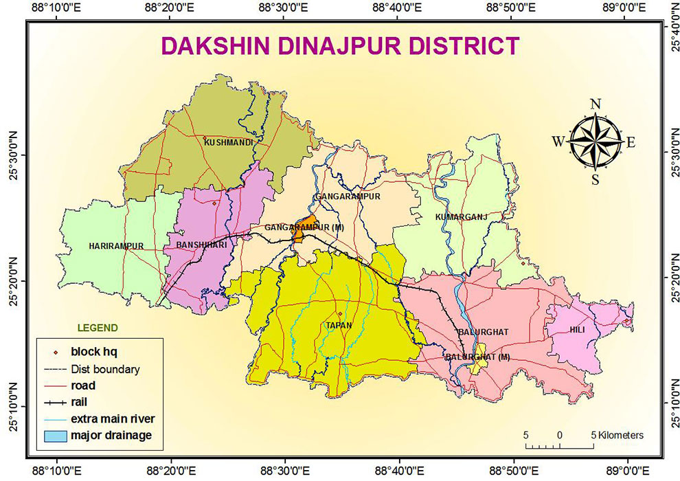
Geographical Area is 2162 sq km. It comprises two subdivisions: Balurghat and Gangarampur.
Administrative Divisions
Balurghat subdivision
Balurghat: municipality.
Hili (Community development block) consists of rural areas only with 5 gram panchayats.
Balurghat (Community development block) consists of rural areas only with 11 gram panchayats.
Kumarganj (Community development block) consists of rural areas only with 8 gram panchayats.
Tapan (Community development block) consists of rural areas only with 11 gram panchayats.
Gangarampur subdivision
Gangarampur: municipality.
Gangarampur (Community development block) consists of rural areas only with 11 gram panchayats.
Bansihari (Community development block) consists of rural areas only with 5 gram panchayats.
Harirampur (Community development block) consists of rural areas only with 6 gram panchayats.
Kushmandi (Community development block) consists of rural areas only with 8 gram panchayats.
According to the 2011 census Dakshin Dinajpur district has a population of 1,670,931 with a Muslim population of 24.01%.
Land Utilization
1. Geographical area: 2,21,480 Ha.
2. Area available for Cultivation: 175620 Ha.
3. Fallow land: 1.24 Ha.
4. Land not available for Cultivation: 26,513
5. Cropping intensity: 183%
6. Area under high yielding variety seed(paddy): 26,125